Who drew the line at the Old River Lea? Listen to the audio file below to find out.

Who drew the line at the Old River Lea? Listen to the audio file below to find out.
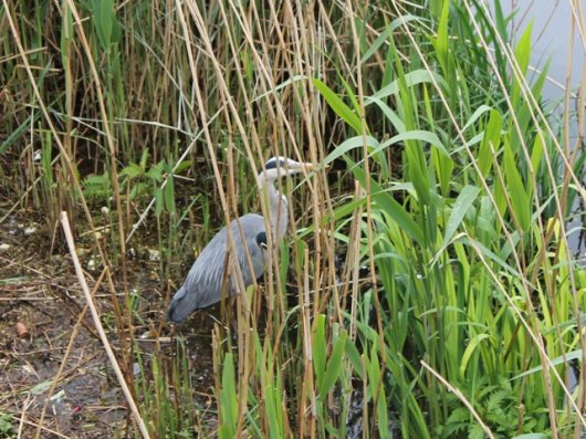
Where you are standing is a place of interesting contrasts; on this side the concrete wharf walls reflect its industrial past while on the other side you can see a reminder of what the rural Lea would have looked like centuries ago.
Between the two banks you can see the remnants of the old flash locks. These were used to control the tidal reaches of the Lea and the canal system downstream.
Over a thousand years ago people standing on opposite banks of the Lea would have been ruled by two very different legal systems. In the 9th century King Alfred the Great made a treaty with the Danish King Gudrun that they would each rule their kingdoms on either side of this river.
Where you are standing now would have been under Danish rule, the opposite bank would have been under the rule of the Angles.
Today these boundaries still exist although as London boroughs-Hackney one side and Newham on the other
Below you can see what was left of the entrance to Pudding Mill River named after a tidal mill to the south this small stream was used until the 18th century. In the 19th century through lack of use it silted and filled up with rubbish. When the London Stadium was built, the river was filled in and disappeared forever.
Continue along the path under the bridges and overhead pipes, and cross back over the Old River Lea at the next footbridge.
This page is part of Start the audio trail